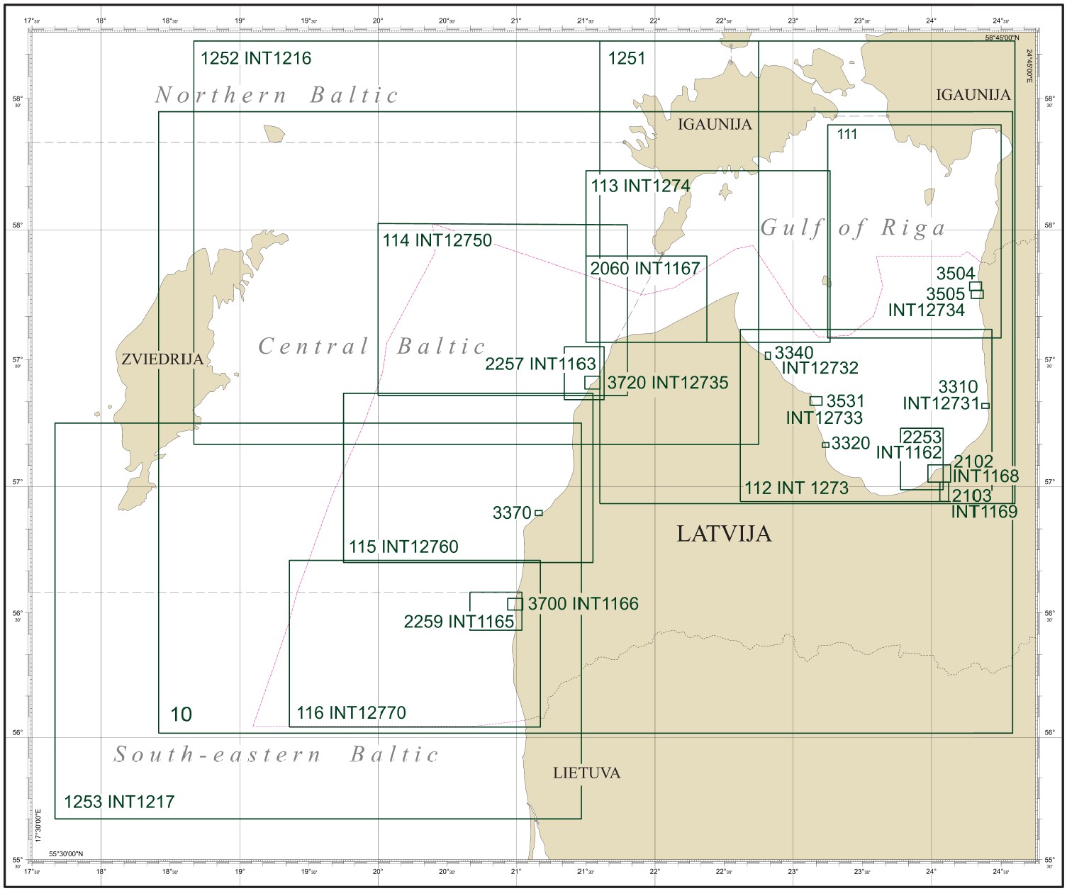
The Maritime Administration of Latvia (MAL) chart folio consists of 25 nautical paper charts, 19 of which are included in the International Hydrographic Organization (IHO) International Chart Catalogue. These charts cover all waters of the Republic of Latvia and are compiled at different scales. When navigating, always use the largest scale nautical chart available for the relevant area.
MAL prints nautical charts in its office using the Print on Demand (POD) system. When purchasing a nautical chart, users receive the latest version of the selected chart, including all updates. After purchase, users are responsible for updating the charts themselves in accordance with the monthly Notices to Mariners published by MAL, available free of charge at www.lja.lv.
All navigation charts issued by MAL are in WGS84 Mercator Projection. Depths and heights in metres referred to Mean Sea Level in Baltic Sea Chart Datum BSCD 2000 (LAS-2000,5). The navigation charts also contain geospatial base data published by the Latvian Geospatial Information Agency, as well as official data that has been used with the permission of the Estonian Transport Administration, the Swedish Maritime Administration, and the Lithuanian Transport Safety Administration.
Nautical Paper Charts can be purchased in the e-shop of the
Maritime Administration of Latvia
MARITIME ADMINISTRATION OF LATVIA
UNIMARS NAVIGATION
17 Duntes Street, LV-1005, Riga, Latvia
Phone: +371 67076360
unimars@unimars.eu
KARŠU VEIKALS JĀŅA SĒTA
85a Elizabetes Street, LV-1050, Riga, Latvia
Phone: +371 67240894
veikals@karsuveikals.lv
HANSAEL
7 Piedrujas Street 7, LV-1073, Riga, Latvia
Phone: +371 67325352
info@hansael.eu; hansael@hansael.eu